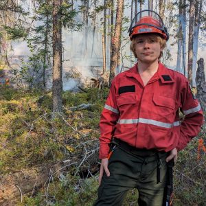
Luke Richardson-foulger

Luke Richardson-foulger

Profile
Profile Display Name:

Luke Richardson-foulger

E-mail Address:

luke.richardson-foulger@kcl.ac.uk

Start Year

2022 (Cohort 9)

Research interests:

Wildfires, Peatlands, Carbon Sequestration, Climate Change, Remote Sensing, Ecosystem Dynamics, Machine Learning, Image Processing, Bayesian Modelling

Hobbies and interests:

PhD Project
PhD Title

High Latitude Peatland Fires and their Greenhouse Gas Emissions.

Research Theme

Environmental Physics and Mathematical Modelling

Primary Supervisor
Primary Institution

KCL

Secondary Supervisor
Secondary Institution

UCL

Abstract

Peatlands are the world’s largest store of terrestrial carbon, an equivalent of ∼ 2/3 of the carbon in the
atmosphere is stored in boreal peatlands alone. Peatlands also support critical biodiversity and help protect
from floods and drought. Wildfires pose an existential risk to peatlands and, since carbon is never fully re-
sequestered, the climate. Peatland wildfires are difficult to detect and map as they can smoulder below the
surface through winter periods, in a form called a zombie fire. This also makes it challenging to quantify a
site’s susceptibility and vulnerability to wildfire activity. In addition, estimates of greenhouse gas emissions in
modern literature typically ignore critical information, such as carbon mineralisation, moisture, and temperature
of different layers of the organic soils as well as the dynamics of the water-table and peat surface.

The project will explore how different remote sensing products can identify and map the extent of peatland
wildfires, particularly subterranean zombie fires. Derived measures of albedo, surface temperature, vegetation
indexes, digital terrain maps, and more will be utilised for detection and tracking. By using these remote
sensing products in conjunction with hydrological models of boreal peatlands, the project will seek to improve
contemporary understanding of peatland susceptibility to fires and how fire activity may evolve in the context
of climate change. The remote sensing products will also be used to improve greenhouse gas emissions estimates
from peat wildfires by more accurately mapping their burn volumes. The emission estimates will also be
improved by investigating emission factor measurements from both lab-based peat pyrolosis experiments and
field-based measurements.

Policy Impact
Background Reading
Collaborators

Canadian Forest Service (CFS)
Ministry of Natural Resources and Forestry (MNRF), Ontario
National Centre for Earth Observation (NCEO)
European Space Agency (ESA)

Publications

None

Activities
Conferences and Workshops
  • Leverhulme Wildfires Summer Conference 2023 (July 2023). Poster: A Bayesian Approach to Deriving Fire Emissions from FTIR Time Series.
  • Fired Up! 2023 (July 2023).
  • NCEO Conference 2023 (September 2023).
Training courses
  • Crew Resource Management (CRM), hosted by British Antarctic Survey.
  • AFFES 101 Orientation / Bear Awareness Training / Basic Forest Firefighter Training, hosted by Aviation, Forest Fires and Emergency Services of Ontario.
  • Airside Training, hosted by Ministry of Northern Development, Mines, Natural Resources and Forestry (Canada).
  • Emergency First Aid at Work, hosted by British Red Cross.
  • Climate Outreach Public Engagement Training, hosted by Climate Outreach.
  • SENSE CDT Firbush Training 2023, hosted by SENSE CDT.

Social Links
University Departmental Website:
Personal Website:

Facebook:

Twitter:
ResearchGate:
LinkedIn:
ORCID:

Stay informed

Click here to subscribe to our RSS newsletter by email.


Find Us

University College London is the administrative lead.

North-West Wing, UCL, Gower Street, London, WC1E 6BT

Follow us on Twitter